 Walk 23 out of 100
Walk #49 - Malham Cove
Yorkshire
Overall Rating - ✪✪✪✪✪
Suggested Difficulty - Moderate
My Difficulty Rating - ✪✪✪
Suggested Time - 3 hours
Actual Time Taken - 3h 10m
Distance in book - 10.3km
Map my walk Distance - 11.09km


 After reaching the cove and taking it all in, the route takes you up the side to climb to the top for amazing views across the Yorkshire Dales. It's an sheer drop to the one side if you're bad with heights (like me) then stay away from the edge! Watch your footing as well, the top is a bit of an ankle buster.


Map my walk Distance - 11.09km
 |
| Visitor centre Start/Finish. |
Completed this walk in January on my 29th birthday, and what a great way to celebrate getting another year older! This has to go down as one of my favourite walks so far, it really does have a bit of everything. The walk starts at the national park car park in Malham, as it is a very popular place to visit, there is an overflow car park in a nearby field which I had to use.
 |
| Malham |
This walk has so much variety which is why I've rated it so highly. Not only does the walk include the impressive Malham cove, but it also includes the spectacular Gordale Scar and the beautiful waterfall, Janet's Foss. There is only one short steep climb to the top of Malham Cove and the rest is fairly straight forward.
 |
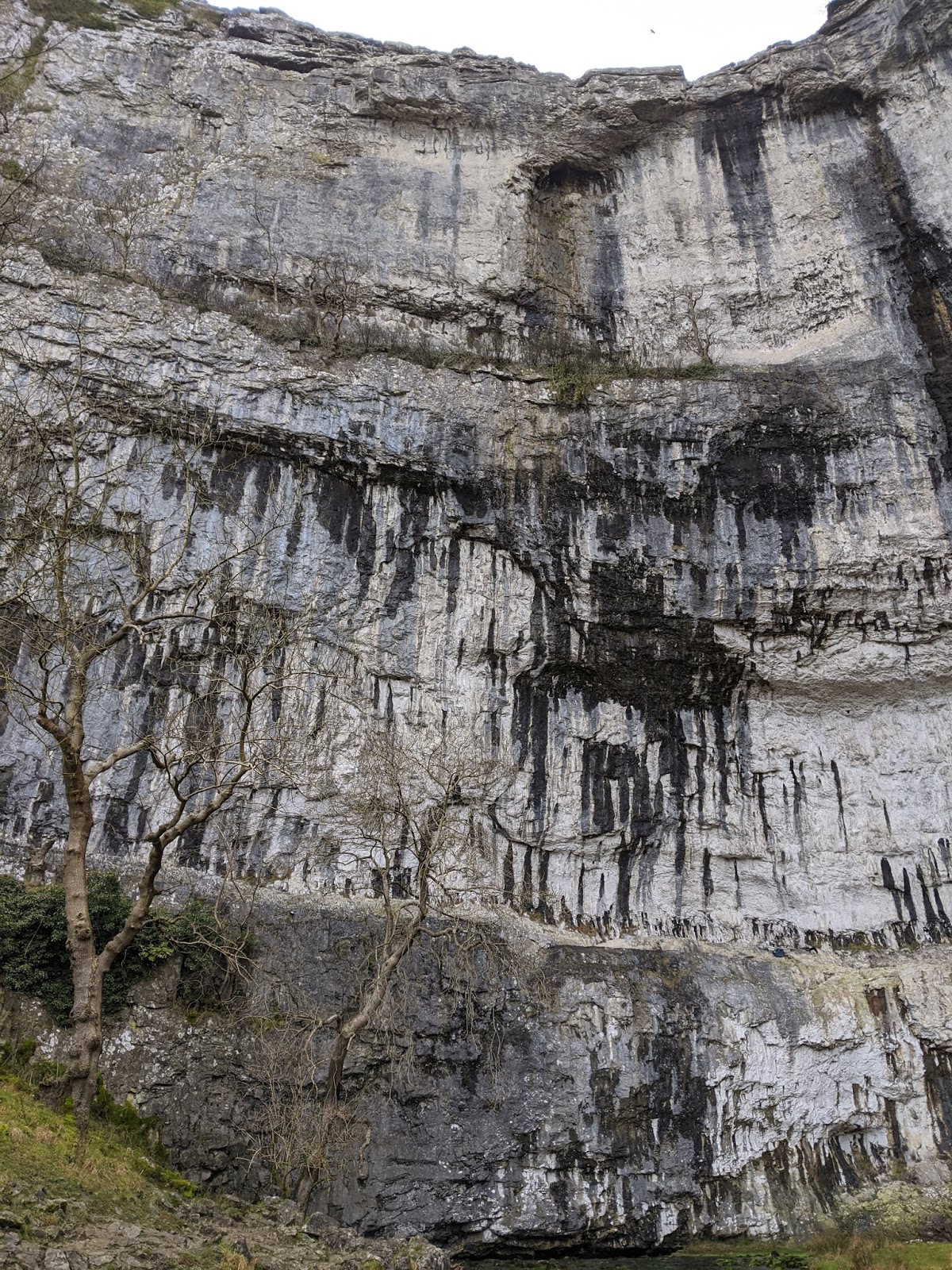
| Approaching Malham Cove |
The first part of the walk leads you through Malham itself before taking you on a clear path along a river which flows out from under the cove. Malham cove is a large limestone rock formation that used to be a waterfall fed by glaciers during the last ice age. It must have been some sight!


 After reaching the cove and taking it all in, the route takes you up the side to climb to the top for amazing views across the Yorkshire Dales. It's an sheer drop to the one side if you're bad with heights (like me) then stay away from the edge! Watch your footing as well, the top is a bit of an ankle buster.

 |
| Approaching Gordale Scar |
The walk doesn't stop impressing you here, a short walk from Malham Cove takes you to Gordale Scar. This limestone ravine consists of 2 waterfalls and overhanging cliffs over 100m high, it really does slap you in the face as you walk around a corner in a seemingly peaceful valley.


 |
| Janet's Foss |
The walk isn't finished with you after the two impressive geological features, it then leads you to Janet's Foss and some beautiful woodland before leading you back towards Malham. Janet is supposedly the name of the fairy queen who lives behind the waterfall (foss being a Nordic word for waterfall). Whether you believe in fairies or not, it's still a pretty spot!

I couldn't recommend this walk highly enough, it's an easy route to follow with a wonderful taster of what the Yorkshire Dales has to offer without taking up your whole day.
Thanks for reading.
Stef.


