Tuesday 1 September 2015

Walk #44 Helvellyn, Cumbria

One of the views from Helvellyn summit
Walk 11 out of 100
Walk #44 - Helvellyn
Cumbria 

Overall Rating - 


Suggested Difficulty - Challenging
My Difficulty Rating - 

Suggested Time - 5 hours
Actual Time Taken - 5h 1m

Distance in book - 15.7km
Map my walk Distance - 16.37km

Grasmere, start
For only my second trip to the Lake District I chose to take on one of the largest peaks in the area, Helvellyn. Standing 950m above sea level it is a bit of a beast to climb compared to most of the other walks I have done so far. The views were spectacular and in my opinion, better than those from Scafell Pike.


Looking back at Grasmere

This walk has been rewarded the full 5 stars for both difficulty and overall rating. It is a tough route to take on, steep ascents, steep descents, but fantastic views from start to finish. Unlike Snowdon the weather was great, and I can't stress enough how much it helped spur me on knowing the panoramic views at the top would be awesome. The timings and distance from the book are probably the closest yet, so well done whoever wrote this one!  


This route was slightly different to the others as it wasn't a loop, but it didn't cause any problems doing the linear walk as there is a regular bus service that runs from the end of the walk back to Grasmere. The route itself was fairly straight forward to follow, the paths are pretty clear all the way along except for a small section at the beginning. The terrain consists of mostly solid paths but there are some rocky sections. There are several individual climbs that make this walk hard going, in particular the steep climb up Dollywaggon Pike. I prefer a constant descent once you've reached the top to ease the rest of the walk but there are still two more small climbs after reaching the summit of Helvellyn which were a bit of a nuisance and just added to the overall difficulty. 
Here's some of the more rewarding parts of the walk...


Dollywaggon Pike & Grisedale Tarn


Views towards the other peaks of the Lake District

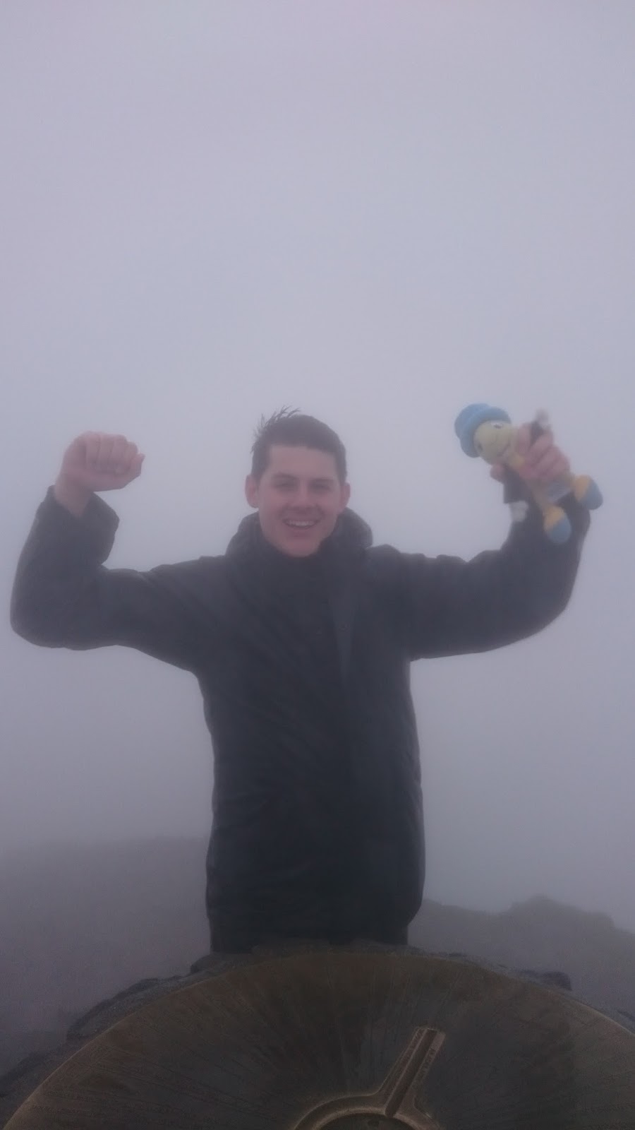
Jiminy on top of Helvellyn


Couldn't resist, looks like a poof of smoke coming out of the mountain!

Looking back at Helvellyn
The final descent

The final descent back down towards the main road was very, very steep and I would not recommend walking the route in the opposite direction unless you are crazy or a mountain goat!


I would highly recommend this walk as the views are stunning and it is a good challenge, if you want to say 'I did Scafell Pike' then go for it, but if you want better views, this is better in my opinion! You also get this lovely waterfall as a reward at the end to cool off...

Thanks to Mike for the company and thanks for reading,  

Stef.


And follow me on Twitter @stefanvilla1991


Sunday 9 August 2015

Walk #98 Snowdon, Gwynedd


Walk 10 out of 100
Walk #98 - Snowdon
Gwynedd 


Overall Rating - 


Suggested Difficulty - Challenging
My Difficulty Rating - 

Suggested Time - 6h 30m
Actual Time Taken - 4h 40m

Distance in book - 13.7km
Map my walk Distance - 15.44km

Rhyd-Ddu station car park, start
So I guess we can say this is the first 'BIG ONE' of the 100 walks as I took on Snowdon, the highest peak in Wales standing at 1,085 metres above sea level. This is actually the second time I have climbed Snowdon, I did it about 3 years ago as part of the 3 peaks challenge. The last time I did the walk I used the Pyg track for the route up, and the Miners' track coming down. This time I took Rhyd-Ddu path up and the Snowdon Ranger path down, this is apparently the quietest route up Snowdon with others such as the Llanberis path being very busy in the summer months. 
Before the hill fog...
I have given this walk a 4 star rating and to be honest it is a 5 star BUT, and it is a big but, the weather was awful. It is probably the reason for the quick completion time as I didn't stop much! My first top tip, make sure you choose a nice day for it. I have done Snowdon twice now and been rewarded with nothing but hill fog and strong winds at the summit, the last time the weather was great until we reached around 800m and the visibility just disappeared but this time it was rubbish most of the way up and about a third of the way down. I must apologise for the rubbish pictures and to be honest, if you just want to see pictures of beautiful views then you may as well stop reading now and search on Google! 

As for the walk itself, it is a great route up the mountain, very quiet, some rough ground, and a bit of a challenge, if you do not walk much, the easier Llanberis (or the train!) might be your best choice to get to the top. The paths are very easy to follow which meant I barely used the map which was an added bonus as the wind would probably have just sent it flying! I imagine walking along the ridges the path had to offer would have been stunning, but well, as you can see the sheer drops into the abyss were hidden by fog...


Summit Cafe... CLOSED!

We did it!

Our first view on the way down as the clouds lifted

Finally left the clouds behind us

The journey down was very straight forward and would be another easy route up the mountain, we were rewarded with a few nice views when the cloud finally lifted (the celebrations were slightly over the top!). The Welsh Highland Railway which runs from Caernarfon to Porthmadog, does stop at the bottom of the Snowdon Ranger path and can take you back to the start in Rhyd-Ddu which would be a nice alternative to avoid road walking at the end. 
Swallow Falls Hotel
I would recommend this walk highly, just do it in good weather! I would also recommend staying the night in the beautiful Betws-Y-Coed after climbing Snowdon. I stayed in Swallow Falls Hotel, good food and most importantly a good bar! 

Thanks to Jake and Neil for the company and as always, Thanks for reading, 

Stef.


And follow me on Twitter @stefanvilla1991
  

Wednesday 24 June 2015

Walk #1 Craswall, Herefordshire

The fantastic ridge walk on Black Hill 
Walk 9 out of 100
Walk #1 - Craswall, Herefordshire

Overall Rating - 


Suggested Difficulty - Moderate
My Difficulty Rating - 

Suggested Time - 3h 30m
Actual Time Taken - 3h 25m

Distance in book - 12km
Map my walk Distance - errrrrm... 12km?

The Bull's Head, start/finish
Firstly for this walk I must apologise for my technical fault as the route on map my walk has the first hour missing as I was so far in the sticks that my phone could not pick up a GPS signal to track the route. Onwards and upwards! The walk starts at the Bull's Head pub in Craswall which has road parking outside. 

I gave this walk a four star, if I'm honest it could have been a two star if it wasn't for the fantastic walk along the narrow ridge line from the summit of Black Hill. The main flaw with the route was the vague directions provided to get up Black Hill. In the end I just said 'SOD IT' and picked a direct route straight up the steep hill, very tiring, felt like a little mountain goat! The steep climb was the only difficult part of the walk physically, the hardest part was finding the path up Black Hill.  
RAIN AHOY!
Jiminy very wary of the huge rain cloud approaching...

RAIN!

Great views from Black Hill
As you can see from the above photographs, I did get rained on, pretty heavily for about 10 minutes whilst on the hill. I do not think it is a coincidence that this happened on a walk that crosses the Welsh border! The weather changes very quickly up there so make sure you are prepared, thankfully I saw the huge rain cloud heading straight for me. I'd recommend this walk for anybody but if you don't fancy the whole route, there is a car park located at the bottom of the ridge line so you can just go up to the summit and back.

Oh and I saw so many sheep on this walk (again, close to Wales!), it was quite nice to see a cow...

Thanks for reading,

Stef.


And follow me on Twitter @stefanvilla1991


Wednesday 10 June 2015

Walk #43 Ward's Stone, Bowland, Lancashire

Walk 8 out of 100
Walk #43 - Ward's Stone, Bowland
Lancashire 

Overall Rating - 


Suggested Difficulty - Challenging
My Difficulty Rating - 

Suggested Time - 5 hours
Actual Time Taken - 4h 28m

Distance in book - 17km
Map my walk Distance - 19.87km

Abbeystead, Start/Finish
This week I ventured into Northern England for my next walk, not quite North of the wall just yet. This very rugged walk went through remote and beautiful moorland. The walk started in the small village of Abbeystead, lots of parking space available outside the school so no parking charges, winner!

Lee
I gave this walk a four popcorn rating as it provided pretty much everything I like in a good country walk. There were plenty of great views from the top of Ward's Stone, lots of wildlife, and a variety of terrain to walk on. I have to say the best part of the walk was the remoteness, I did not see another person walking until I made it back to the village. Some walks can be spoilt a little from over crowding.

I wouldn't class this walk as particularly challenging, there was a steady incline up Ward's Stone but for half of it you are walking along well kept gravel tracks and the majority of the other paths are fairly soggy peat, hard to follow at times but nothing too difficult. It may however be a lot more tricky in bad weather, and I could imagine the peaty areas getting far more boggy.

Approaching Ward's Stone

The second trig point on Ward's Stone
There are a few interesting rock formations along the plateau of Ward's Stone, all with random names to try and make them more interesting than just rocks; The Queen's Chair and The Grey Mare with Foal. So for all you rock lovers out there...


I would give this walk a high recommendation for those who love great views, the view over Morcambe Bay and Lancaster is pretty impressive. Also for those who like the idea of getting off the beaten track a little more, but if you are not comfortable being out on your own, take a mate.

Thanks for reading,

Stef.


Friday 22 May 2015

Walk #24 Avebury, Wiltshire

A section of Avebury Stone Circle
Walk 7 out of 100
Walk #24 - Avebury 
Wiltshire 

Overall Rating - 


Suggested Difficulty - Moderate
My Difficulty Rating - 

Suggested Time - 4 hours
Actual Time Taken - 4 hours

Distance in book - 12.8km
Map my walk Distance - 15.89km

National Trust car park Start/Finish
Part two of my trip was in the beautiful prehistoric site surrounding Avebury village. I apologise in advance for the waffle you are about to read, being a historian I get a little bit carried away when talking about history! If you have a National Trust membership park here>>> if not, then prepare to be stung with a £7 charge for parking.


I've given this walk a four star, the history was definitely the deciding factor in giving this walk a high rating. There are several Neolithic sites in the area which the walk includes: Avebury Stone Circle, Silbury Hill, West Kennet Long Barrow, and Windmill Hill.


Silbury Hill
The first two prehistoric sites seen on the walk are Silbury Hill and West Kennet Long Barrow. Silbury Hill is an artificial chalk mound completed around 2,400BC and the reason this hill was built is unknown. The mystery behind it makes the largest man-made mound in Europe rather intriguing.  


West Kennet Long Barrow
A short walk from Silbury Hill is West Kennet Long Barrow, a chambered Neolithic tomb built around 3,650BC and the resting place of around fifty people before being sealed.
Silbury Hill from West Kennet Long Barrow

Inside West Kennet Long Barrow
Stone Avenue leading to Avebury
Avebury itself is a village built within an ancient stone circle. Built between 2850BC and 2200BC, there is one large stone circle with two smaller circles enclosed within. Part of the village, including a pub are the more recent additions to the stone circle. Again, the purpose of the circle still baffles Historians which makes it all more interesting!

The Red Lion, Avebury

St James's Church
Windmill Hill on the horizon.

The final site the walk includes is Windmill Hill, a Neolithic 'causewayed enclosure', with three concentric but intermittent ditches. It is estimated that it was first occupied around 3800BC.


View back towards Silbury Hill from Windmill Hill

This walk was very enjoyable, the history was fascinating and the scenery beautiful. It wasn't a difficult walk apart from maybe the small climb up Windmill Hill so I would recommend it for anyone. Even if you didn't want to walk and just wanted to view the history, you can drive between most of the sites. 

Thanks to Neil for being my travel companion, and as always thanks for reading,